Trail Walking La Godivelle - Godivelle_Brion_Jassy - Photo
 jagarnier
jagarnier

User GUIDE

© OpenStreetMap contributors
Length
Length
16.3 km
Max alt
Max alt
1272 m
Uphill gradient
Uphill gradient
386 m
Km-Effort
Km-Effort  
21 km
Min alt
Min alt
1142 m
Downhill gradient
Downhill gradient
386 m
Boucle
Boucle
Yes
Creation date :
2020-02-03 05:53:26.349
Updated on :
2023-11-15 10:06:27.651

(2 Reviews)

Walking
Walking
5h00
Difficulty : Medium

Scan this QR Code to open this trail in the SityTrail application

FREE GPS app for hiking

Logo SityTrail SityTrail

IGN / Geographical institutes

Download SityTrail from the App Store Download SityTrail from Google Play

Logo SityTrail SityTrail World

The world is yours!

Download SityTrail from the App Store Download SityTrail from Google Play Download SityTrail on Huawei AppGallery

About

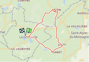
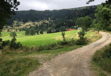
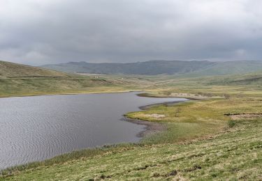
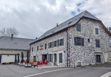
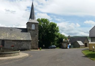
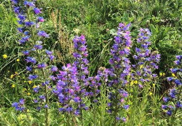
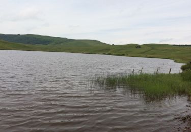
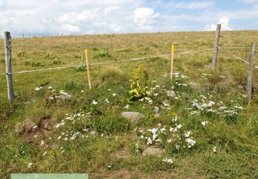
Trail Walking of 16.3 km to be discovered at Auvergne-Rhône-Alpes, Puy-de-Dôme, La Godivelle. This trail is proposed by jagarnier.

Description

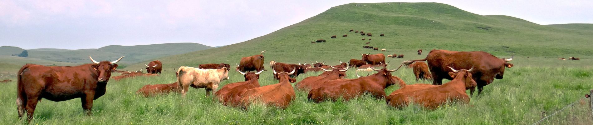
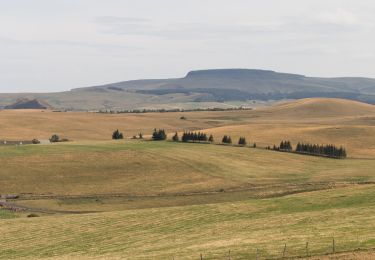
En 4h de randonnée, vous toucherez à l’immanquable de ce surprenant et somptueux territoire : Le Cézalier. La Godivelle, Brion, Jassy, les lacs et tourbières du Cézallier, la Réserve Naturelle des Sagnes et de la Godivelle. Un paradis !

Elevation profile

Photos

Positioning

Country:
France
Region :
Auvergne-Rhône-Alpes
Department/Province :
Puy-de-Dôme
Municipality :
La Godivelle
Location:
Unknown
Start:(UTM)
493636 ; 5026202 (31T) N.

Comments

Please log in to post a review or rate the element


Trails nearby

Trail On foot Espinchal - Le Bois de Play - Photo
On foot
PRO

On foot

Easy
Espinchal, Auvergne-Rhône-Alpes, Puy-de-Dôme, France
3.6 km | 5.6 km-effort
1h 16min
Yes
Trail On foot Saint-Alyre-ès-Montagne - Jassy - Photo
On foot
PRO

On foot

Easy
Saint-Alyre-ès-Montagne, Auvergne-Rhône-Alpes, Puy-de-Dôme, France
14.1 km | 18.4 km-effort
4h 11min
Yes
Trail Walking Compains - Brion-Anzat le Luguet TVR  - Photo
Walking
alinetpierre

Walking

Medium
Compains, Auvergne-Rhône-Alpes, Puy-de-Dôme, France
16.7 km | 22 km-effort
3h 31min
No
Trail Walking La Godivelle - boucle la godivelle jassy 15km - Photo
Walking
famillerudent

Walking

Medium
(1)
La Godivelle, Auvergne-Rhône-Alpes, Puy-de-Dôme, France
15 km | 19.2 km-effort
4h 37min
Yes
Trail Walking Montgreleix - boucle de 9 km autour de  montgreleix - Photo
Walking
famillerudent

Walking

Difficult
Montgreleix, Auvergne-Rhône-Alpes, Cantal, France
9.2 km | 12.2 km-effort
2h 46min
Yes
Trail Walking La Godivelle - La Godivelle - Mt Chamaroux - la Godivelle  - Photo
Walking
meunier.ph.

Walking

Medium
La Godivelle, Auvergne-Rhône-Alpes, Puy-de-Dôme, France
16.8 km | 23 km-effort
4h 30min
Yes
Trail Walking Saint-Alyre-ès-Montagne - Boutaresse  - Photo
Walking
GUIDE
antignacs

Walking

Very easy
Saint-Alyre-ès-Montagne, Auvergne-Rhône-Alpes, Puy-de-Dôme, France
5.6 km | 7.4 km-effort
1h 28min
Yes
Trail Walking Saint-Alyre-ès-Montagne - Jassy brion La Godivelle  - Photo
Walking
GUIDE
antignacs

Walking

Easy
Saint-Alyre-ès-Montagne, Auvergne-Rhône-Alpes, Puy-de-Dôme, France
14.9 km | 19.4 km-effort
5h 0min
Yes
Trail 4x4 Montgreleix - Mongreleix - Photo
4x4
Martial Faulconnier

4x4

Very easy
Montgreleix, Auvergne-Rhône-Alpes, Cantal, France
10.9 km | 13.9 km-effort
55min
No


Close
My subscriptions